


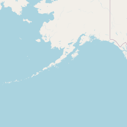

Departure Airport Eau Claire - United States (EAU) Destination Airport Port Hardy - Canada (YZT)
Departure Airport
Eau Claire - United States (EAU)

Current Time: CST
Destination Airport
Port Hardy - Canada (YZT)
Current Time: PST
Distance: 2729.10 km / 1695.79 miles
www.distanceairport.com
Estimated Flight Duration: 3h 25m
Calculate Distance Between Airports
Welcome to our comprehensive platform, designed to serve travelers, logistics professionals, aviation enthusiasts, and anyone in between. Our primary aim is to offer you a seamless way to calculate the exact distance between any two airports worldwide.
Other distances
From EUN to SHE From VAW to TZA From GUW to SUJ From ABE to CTL From KSA to EGO From MEE to TLH From XBJ to NLA From MSU to NAJ From LNY to IXL From DAY to ALP
© Doorify Tech S.r.l. - 2023-2025 - Made by
Trouble Flight