


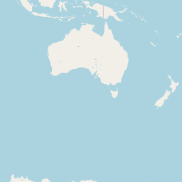


Departure Airport Ayers Rock - Australia (AYQ) Destination Airport Twin Falls - United States (TWF)
Departure Airport
Ayers Rock - Australia (AYQ)

Current Time: GMT+9:30
Destination Airport
Twin Falls - United States (TWF)
Current Time: MDT
Distance: 13832.96 km / 8595.40 miles
www.distanceairport.com
Estimated Flight Duration: 17h 17m
Calculate Distance Between Airports
Welcome to our comprehensive platform, designed to serve travelers, logistics professionals, aviation enthusiasts, and anyone in between. Our primary aim is to offer you a seamless way to calculate the exact distance between any two airports worldwide.
Other distances
From OVB to DIG From PYY to DIE From PAR to LYP From RME to CWB From AAY to EPL From LSH to BNY From YVB to CGI From MAK to PHF From MNG to MBL From AAT to SNC
© Doorify Tech S.r.l. - 2023-2025 - Made by
Trouble Flight