


Departure Airport Gyandzha - Azerbaijan (KVD) Destination Airport Wajima - Japan (NTQ)
Departure Airport
Gyandzha - Azerbaijan (KVD)

Current Time: GMT+4
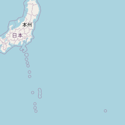
Destination Airport
Wajima - Japan (NTQ)
Current Time: GMT+9
Distance: 7465.36 km / 4638.76 miles
www.distanceairport.com
Estimated Flight Duration: 9h 20m
Calculate Distance Between Airports
Welcome to our comprehensive platform, designed to serve travelers, logistics professionals, aviation enthusiasts, and anyone in between. Our primary aim is to offer you a seamless way to calculate the exact distance between any two airports worldwide.
Other distances
From MYQ to SUS From KBU to CNQ From ULN to RPR From SEA to FSM From YDT to USU From MFA to IOM From UEL to KSQ From SHA to MNL From YMQ to DEA From GDL to BSO
© Doorify Tech S.r.l. - 2023-2025 - Made by
Trouble Flight